Spain 2016
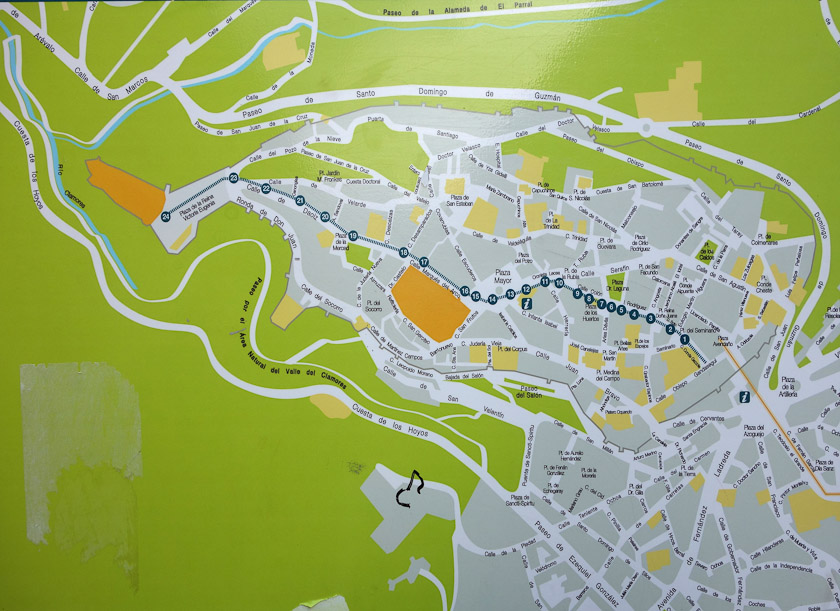
The elevated aqueduct is the tan line on the right, passing the tourist information (marked i) and entering the walls. Thereafter the water followed an underground path marked with a dashed green line. Its path is currently marked at the numbered locations 1-24 by bronze markers set in the street. The end of the adqueduct was at the Alcazar, the tan shape at the upper left.
March 21, 2016